
Philip's Maps - Philip's Local Explorer Street Atlas Buckingha
Philip's Maps - Philip's Local Explorer Street Atlas Buckingha
Low stock: 3 left
Free Shipping
Couldn't load pickup availability
About this Item
The item is a book Spiral
The Author Name is Philip's Maps
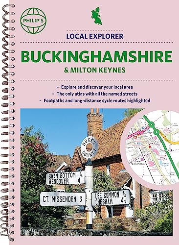
The Title is Philip's Local Explorer Street Atlas Buckinghamshire and Milton Keynes
Condition New
Other Comments
New Store Stock
Product Description -
Philip's created this new series for walkers, cyclists and local explorers at a scale that provides greener options to uncover all the nature and hidden gems in your local area. With over 18,000 streets and lanes and alleys, and from Aylesbury to Wolverton, we cover Buckinghamshire in enticing detail. Who hasn't explored and enjoyed their surrounding area in recent years and come to appreciate what is on our respective doorsteps? Philip's have created this new series for walkers, cyclists and local explorers at a scale that provides greener options to uncover all the nature and hidden gems in your local area. Includes all the streets in AYLESBURY, BLETCHLEY, CHESHAM, HIGH WYCOMBE, MILTON KEYNES, SLOUGH, Amersham, Beaconsfield, Berkhamsted, Buckingham, Burnham, Chalfont St Giles, Chalfont St Peter, Chesham Bois, Chorleywood, Cookham, Denham, Flackwell Heath, Gerrards Cross, Great Missenden, Haddenham, Hazlemere, Iver, Linslade, Little Chalfont, Loudwater, Loughton, Maidenhead, Marlow, Newport Pagnell, Olney, Prestwood, Princes Risborough, Stoke Mandeville, Stoke Poges, Stony Stratford, Thame, Tring, Uxbridge, Wendover, Windsor, Winslow, Wolverton. The detailed scale allows explorers, walkers and cyclists to avoid main roads and select pathways, bridleways and lanes for optimum enjoyment. Whether it's meandering through the local parks or historic houses, exploring neighbourhood nature spots or the local town, we have the clear mapping and information you need. If you do have to travel to reach areas you'd like to explore, all A and B roads are clearly shown on our Route Planner and we include. Exceptional detail allows the user to pinpoint exactly where they need to go and the best route to follow. * The only atlas with every road, street and lane in the county named, along with the best pedestrian routes, long-distance cycle routes. * Highlighting lanes, alleyways, footpaths and bridleways, camping and caravan sites, golf courses, parks, gardens and many, many other places of interest* Contains all the usual one-way streets, barriers, car parks, railway and bus stations, hospitals, colleges and schools, police and fire stations, places of worship, post offices, shopping and leisure centres
When possible we will add details of the items we are selling to help buyers know what is included in the item for sale. The details are provided automatically from our central master database and can sometimes be wrong.
Books are released in many editions and variations, such as standard edition, re-issue, not for sale, promotional, special edition, limited edition, and many other editions and versions. The Book you receive could be any of these editions or variations. If you are looking for a specific edition or version please contact us to verify what we are selling.
Gift Ideas
This is a great gift idea.
Hours of Service
We have many warehouses, some of the warehouses process orders seven days a week, but the Administration Support Staff are located at a head office location, outside of the warehouses, and typically work only Monday to Friday.
Location ID 245z
iHaveit SKU ID 174148279
SKU: SKU:174148279
Materials
Materials
Dimensions
Dimensions
Care Instructions
Care Instructions
Shipping & Returns
Shipping & Returns

Free Shipping
We provide free shipping for all products within the UK