
British Isles Communication - Map
British Isles Communication - Map
Low stock: 4 left
Free Shipping
Couldn't load pickup availability
About this Item
The item is a book Map
The Title is British Isles Communication
Condition New
Other Comments
New Store Stock
Product Description -
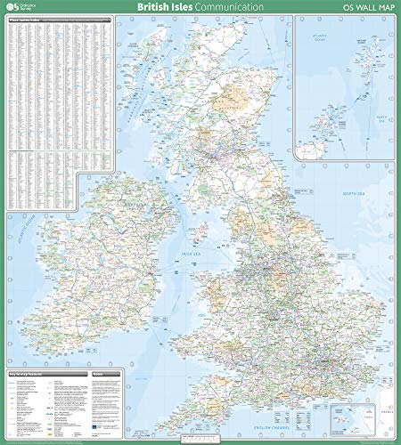
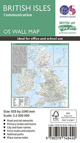
This map shows the British isles, with all the major road, rail and sea connections. It is supplied rolled in a tube and is ideal for schools, students or just for decoration. It includes an index of place names. This map is gloss coated, so can be written on with suitable dry-wipe pens. It's scale is 1: 1 000 000
When possible we will add details of the items we are selling to help buyers know what is included in the item for sale. The details are provided automatically from our central master database and can sometimes be wrong.
Books are released in many editions and variations, such as standard edition, re-issue, not for sale, promotional, special edition, limited edition, and many other editions and versions. The Book you receive could be any of these editions or variations. If you are looking for a specific edition or version please contact us to verify what we are selling.
Gift Ideas
This is a great gift idea.
Hours of Service
We have many warehouses, some of the warehouses process orders seven days a week, but the Administration Support Staff are located at a head office location, outside of the warehouses, and typically work only Monday to Friday.
Location ID 245z
iHaveit SKU ID 174023052
SKU: SKU:174023052
Materials
Materials
Dimensions
Dimensions
Care Instructions
Care Instructions
Shipping & Returns
Shipping & Returns

Free Shipping
We provide free shipping for all products within the UK